By National Weather Service in Cheyenne, WY
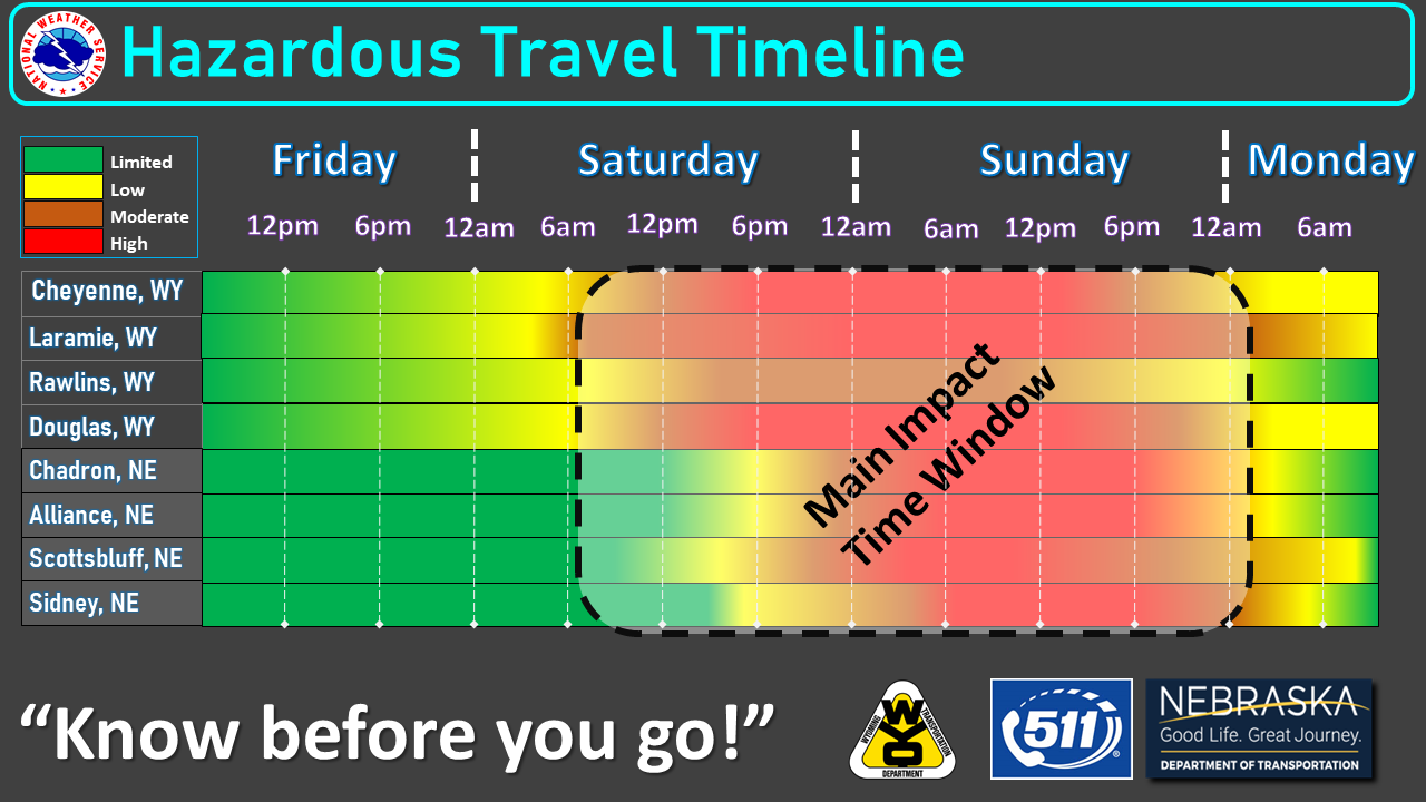
Gearing up this weekend with some Winter Storm Watches and Warnings. At this time, the worst conditions are forecast to occur Saturday morning through Sunday evening.
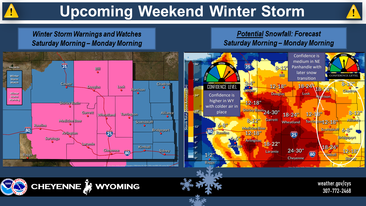
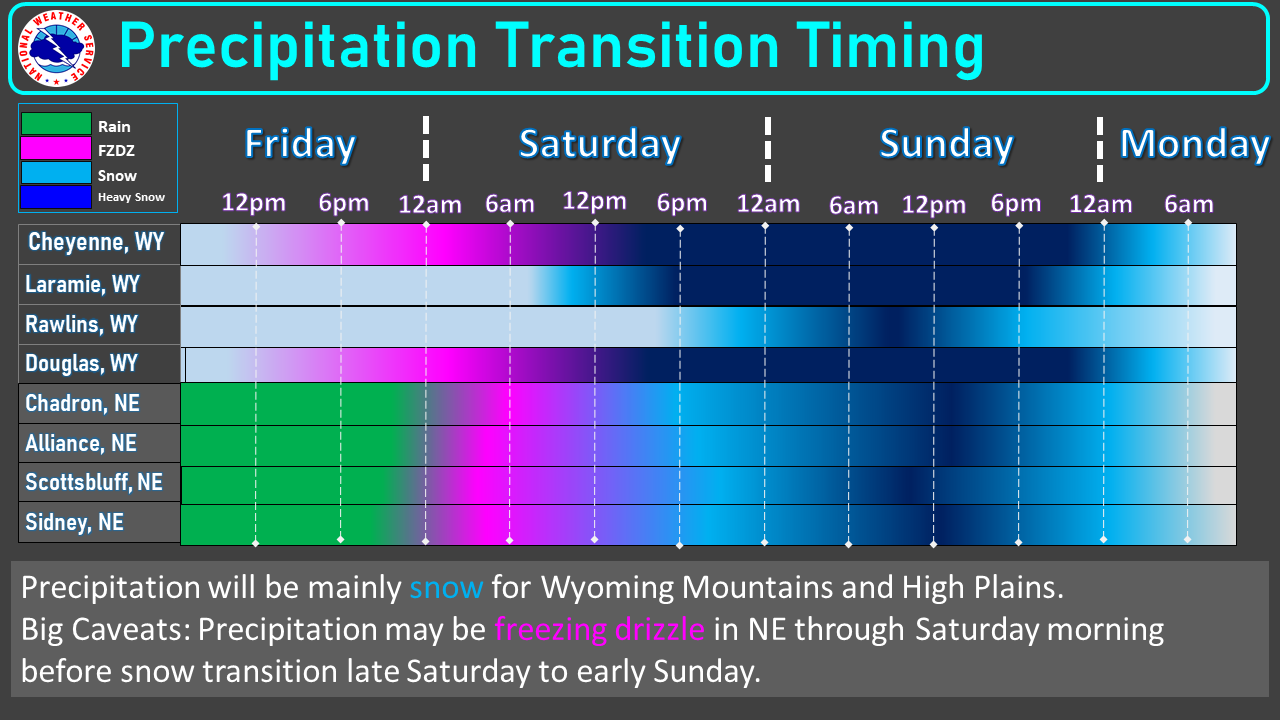
We have medium confidence in the Nebraska Panhandle for snow totals, with the region having slightly higher temperatures, slowing down the transition from rain to snow than originally anticipated.
There is higher confidence in the snow totals for southeastern Wyoming, with colder temperatures expected.
Heavy, snow-packed roads are expected along with gusty winds and low visibility making travel difficult to impossible, especially Saturday afternoon through most of Sunday.
Precipitation may begin as freezing drizzle east of the Laramie Range into the Nebraska Panhandle late Friday night into Saturday morning before transitioning to all snow Saturday afternoon.
Heaviest snowfall is expected to begin Saturday afternoon with winds strengthening overnight Saturday.
Be sure to be prepared for all outdoor activities, include shoveling driveways, as more effort may be required to lift the snow during the weekend.
The weather Impact Level for today through Monday is: High
Here are the current weather event impact highlights:
- Winter Storm Warning begins tonight and continues through Monday morning for the potentially historic snow storm for southeastern Wyoming and portions of the Nebraska Panhandle.
- Worst conditions are forecast to occur Saturday afternoon through Sunday evening due to a combination of heavy snow and gusty winds. Blizzard conditions are possible. Look for a new warning issuance later today.
- Impacts: Heavy, snow-packed, and icy roads, as well as gusty winds and low visibilities, especially Saturday afternoon and Sunday. Mixed precipitation today will increase the threat to area livestock. Cold wind chills will lead to extreme conditions Sunday morning. May need to protect area livestock and avoid prolonged outdoor exposure. Wind chills will be 15 degrees and below.