By National Weather Service in Cheyenne, Wyoming,
Folks across southeast Wyoming and Nebraska Panhandle are in for an active weather day.
A Marginal Risk area for severe thunderstorms covers most of the area.
A Slight Risk area for severe thunderstorms cover much of Converse, Niobrara Counties in east central Wyoming and the northern Nebraska Panhandle.
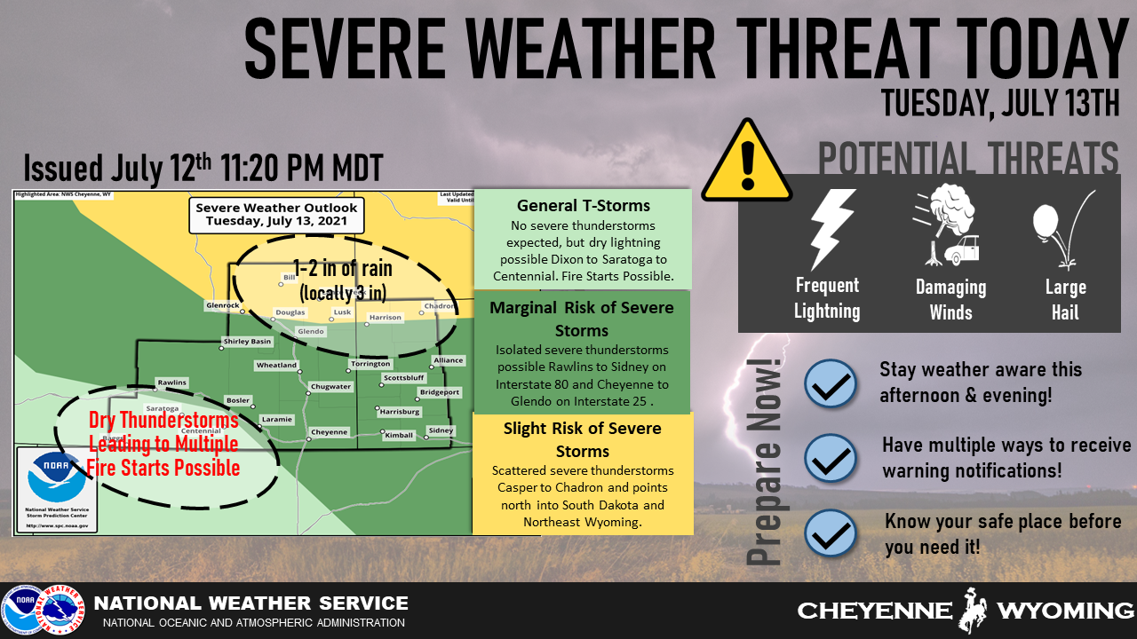
Storms are expected to develop early this afternoon and could continue through the late evening.
Very large hail to golfballs, downburst winds to 70 MPH, frequent lightning and heavy rainfall leading to localized flash flooding, are all possible east of the Laramie Range.
Out west of the Laramie Range, high based thunderstorms with little rainfall and very strong downburst winds to 60 mph are possible, leading to multiple fire starts and erratic fire spreads.
Keep an eye on the sky today as this could be a busy weather day. Have multiple ways to receive future warnings if you are traveling.