By National Weather Service in Cheyenne, WY
Snow is on the way. A Winter Storm Warning has been issued for parts of our area for the incoming storm system. A Winter Weather Advisory has been issued for Laramie County, plus the Laramie and North Platte valleys in SE Wyoming, and Scotts Bluff, Banner, and Morrill counties in Nebraska.
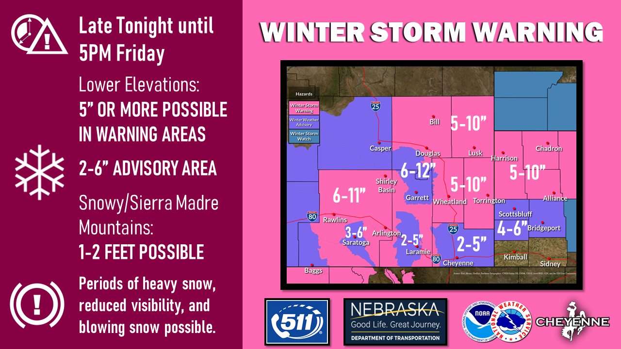
Snow is expected to begin tonight in the mountains first, then spread into the lower elevations of Carbon and Albany county Thursday morning. Snow will increase east of I-25 and in the Nebraska panhandle Thursday afternoon into the evening. Expect snow to taper off from west to east starting Friday morning.
Accumulations will vary across our area. In the warning areas (pink), 5-10” of snow accumulation is anticipated in east central Wyoming and the northern Nebraska Panhandle. 6-11” is expected in Carbon County. The mountains are expected to receive 1-2 feet.
In the advisory areas (purple), generally 2-6” of snow can be expected for the lower elevations, with 6-12” in the North Laramie Range. Uncertainty is greater for the city of Cheyenne at this time as the best chance for higher totals will be in the northern part of the county.
Snow could be heavy at times, and lead to reduced visibility. Periods of blowing snow are also possible.