By National Weather Service in Cheyenne, WY
Be sure to stay up-to-date on the forecast in southeast Wyoming and the Nebraska panhandle the next few days as we go straight from high winds into snow.
High Wind Warnings are in effect for most of southeast Wyoming and the Nebraska panhandle where very high wind gusts area likely through Tuesday afternoon.
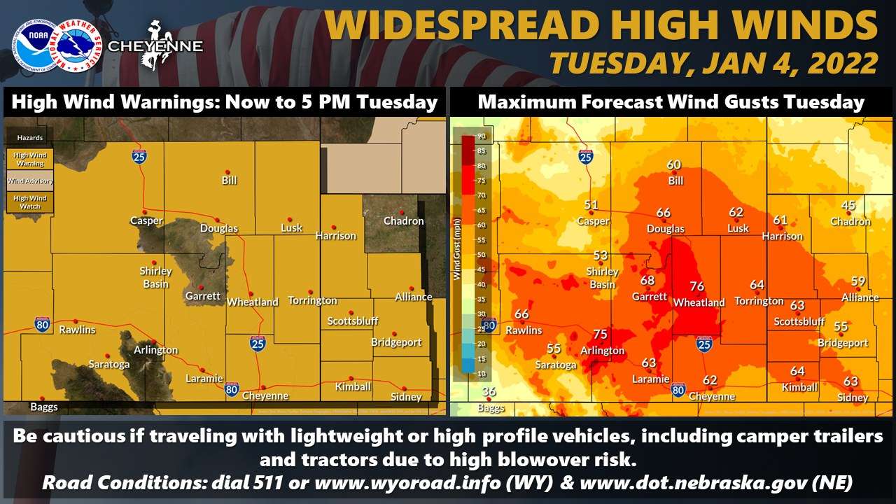
Wind prone areas of southeast Wyoming (Arlington, south Laramie Range and Bordeaux) could see wind gusts up to 75 mph Tuesday with 60-70 mph elsewhere. Blowover risk will be quite high Tuesday across much of the area. A brief lull in the winds will occur Tuesday evening, before picking back up on Wednesday.