By National Weather Service in Cheyenne, WY
Winter Storm Warnings and Winter Weather advisories have been issued for much of our region for the expected snow event early today through Thursday.
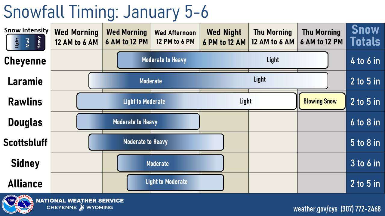
Most of the snowfall is expected from the mid morning through the mid afternoon tomorrow, but light snow could linger in southern Wyoming through Thursday morning.

The best chance for more than 6 inches or more of snow will be in bands of moderate to heavy snow that set up from northwest to southeast from the northern Laramie range through Platte, Goshen, and northern Laramie counties in Wyoming, then towards the region in between Scottsbluff, Kimball, and Sidney in Nebraska.
Blowing snow and strong winds are likely in Carbon/Albany counties Wednesday morning through early afternoon. North winds with gusts to 30 MPH are possible east of the Laramie range during the day on Wednesday which could lead to blowing snow. Winds will increase again on Thursday afternoon, especially further west.