By Nebraska National Forests and Grasslands
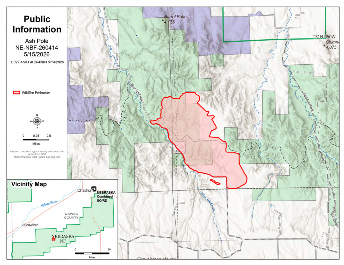
CHADRON, Neb. — Progress on the Ash Pole Fire has been steady despite red flag conditions and heavy fuels. The estimated burn area remains 1,100 acres, and containment is at 47 percent. Crews worked through the night and were able to hold all lines established Thursday. As a result, no aircraft support is currently requested.
The fire is burning within the previous burn scar of the 2012 West Ash Fire, where dead and downed fuels are abundant and can readily ignite. These fuels, combined with ongoing red flag warning conditions, low relative humidity and high temperatures, continue to challenge suppression efforts.
The fire area contains interior pockets of heat, and smoke remains due to the large amount of fuel. Weather conditions indicate that smoke dispersal should improve by this afternoon and evening. For smoke conditions in your area, please visit https://fire.airnow.gov/.
Fire managers remind the public to stay away from the fire area, as observers have impeded firefighter access. Public and firefighter safety remain the top priority. Fire managers also thank the surrounding community, cooperators and volunteers for their support during this incident.
For ongoing updates, please visit Nebraska National Forests and Grasslands website, Facebook page, and InciWeb, the interagency incident information system.