By National Weather Service in Cheyenne, WY
A Winter Storm Watch has been issued for much of our area for heavy snow possible late Wednesday night through Friday morning.
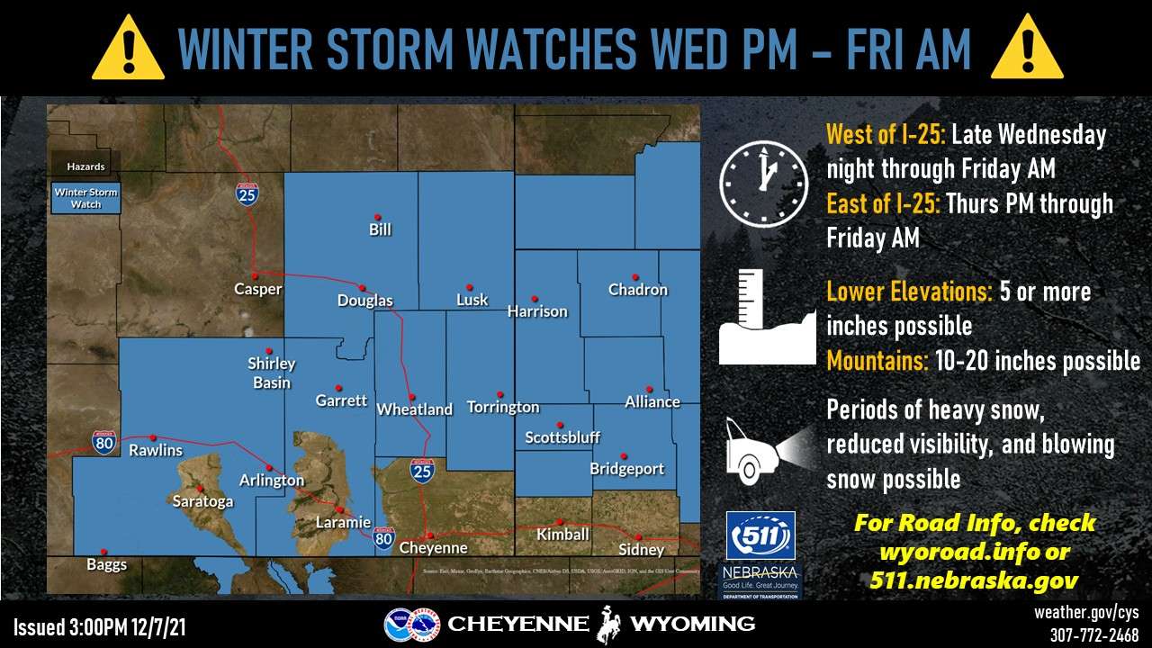
Snow is expected to begin first in the mountains late Wednesday night, spread to the lower elevations in Carbon/Albany counties Thursday morning, and then reach the plains Thursday afternoon.
Total accumulations of 5 or more inches are possible in the lower elevations of the watch area, with 10-20 inches in the Sierra Madre and Snowy ranges. Uncertainty is greater for the I-80 corridor at this time, so please stay tuned for the latest!