By National Weather Service in Cheyenne, WY
Here is your forecast for Thursday across southeast Wyoming and Nebraska Panhandle.
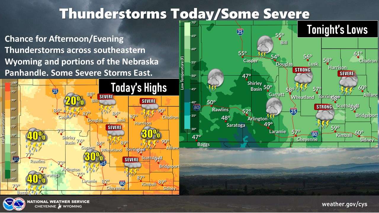
A cold front will move through the area today.
Expect afternoon showers and thunderstorms to develop, as this front moves through this afternoon and evening.
Storms could persist through the late evening.
Severe storms are possible this afternoon and evening east of the Laramie Range.
Main hazards will be large hail to the size of golf balls and 60+ mph winds, along with frequent lightning.
Highs today will range from 75 at Shirley Basin to 90 at Chadron. Overnight lows will range from 47 at Baggs to 61 at Chadron.