Chadron, N.E.— The South Fork Fire remains at 39,696 acres and containment is now at 100%. Fire suppression repair continues - there are areas of heat or smoldering stump holes well into the interior of the fire that does not present a threat to continued fire growth. Firefighters are patrolling for any remaining heat, utilizing hose from fire engines to thoroughly soak priority areas, and felling hazard trees that could pose risks to the public—particularly along frequently used trails within Fort Robinson State Park. Road grading and dozer line repairs are also underway.
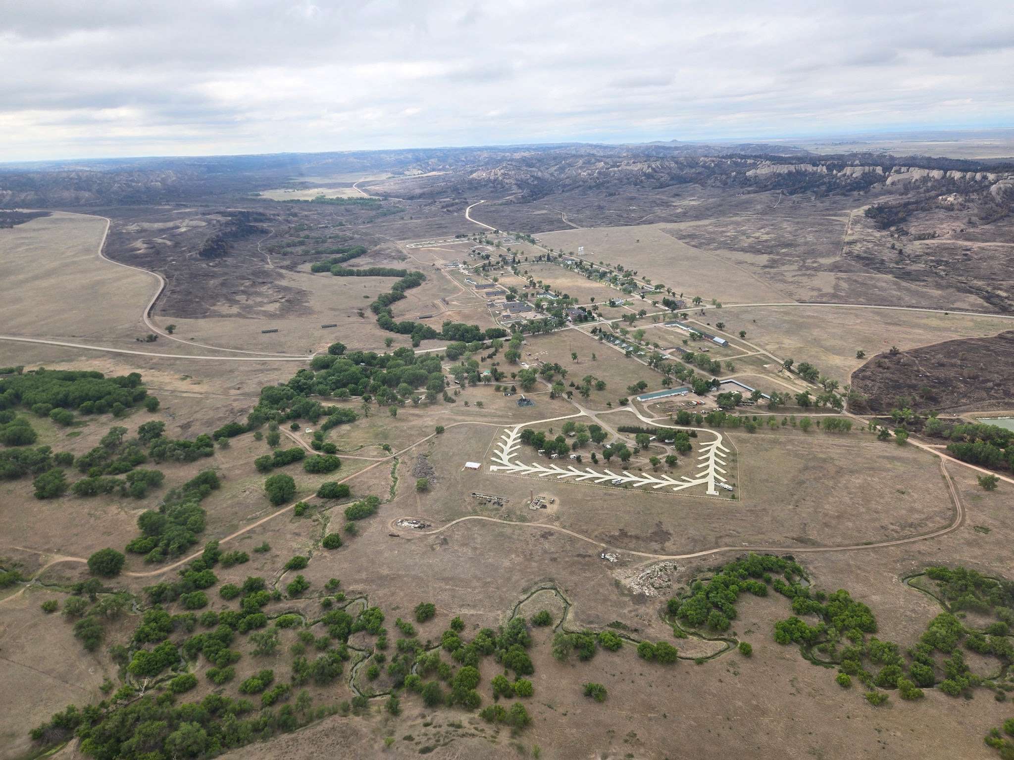
The Burned Area Emergency Response (BAER) team has been in the field assessing priority areas related to life and safety, including watershed health. Given the scale of the incident, US Forest Service hydrologists conducted aerial assessments to better understand strategies for reducing risks such as flash flooding in the event of significant precipitation. Archeologists were also on the flight to get a good look at areas of cultural significance.
The team is assessing roads, culverts, trails, and other infrastructure to determine what resources are immediately needed for safest public access. Aerial assessments help minimize disturbance to the fragile post‑fire landscape, which currently lacks the resiliency of areas with intact vegetation.
The speed and scope of this aerial evaluation allow the BAER team to identify burn severity, watershed conditions, and areas of immediate concern, enabling them to make informed decisions on erosion mitigation and visitor safety. In light of these conditions, there is an increased risk of flash flooding today, with afternoon thunderstorms forecast. Visitors are advised to use caution when traveling in the area.
Future assessments are still planned for the area, including further cultural resource evaluations. Cultural considerations are an essential component of every BAER assessment, but given the significant historical and cultural importance of this landscape, they will be especially critical here. Local tribes will also participate in these assessments to ensure their perspectives, knowledge, and priorities are fully incorporated.
Incident management for the South Fork Fire will transition back to the Nebraska National Forests and Grasslands at 10 p.m. this evening, June 24th. The Forest extends its thanks to the Rocky Mountain Complex Incident Management Team 2 for its dedicated support during the period of elevated operational complexity. Their collaboration and continued assistance during the transition to a Type 4 organization have been greatly appreciated.
For future updates regarding South Fork Fire, please follow the Nebraska National Forests and Grasslands Facebook Page, and InciWeb, the interagency incident information system.