By Rocky Mountain Complex Incident Management Team 2
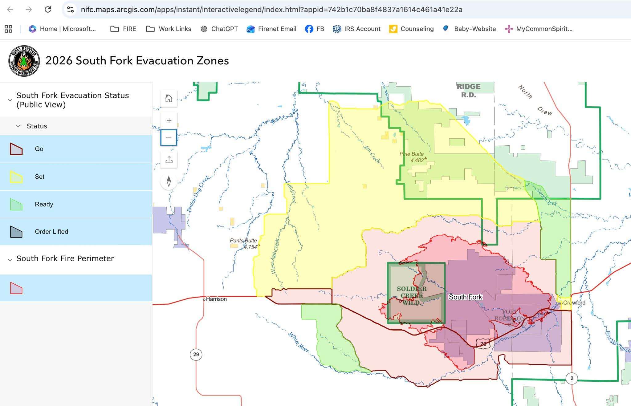
Please see the new interactive evacuation map for the South Fork Fire that allows residents to quickly determine whether their specific address is within an evacuation area.
Using the map, you can:
✅ Search for your address
✅ View current evacuation zones
✅ See evacuation status boundaries at a detailed, address-level view
This tool provides a more user-friendly way to access evacuation information and can help residents make informed decisions during rapidly changing fire conditions.
To use the map, simply enter your address in the search bar and zoom in to view evacuation information for your area.
🔗 Interactive Evacuation Map: https://nifc.maps.arcgis.com/apps/instant/interactivelegend/index.html?appid=742b1c70ba8f4837a1614c461a41e22a
Please remember that evacuation statuses can change as fire conditions evolve. Continue to monitor official South Fork Fire information sources, local emergency management notifications, and emergency alerts for the most current information.