By National Weather Service in Cheyenne, WY

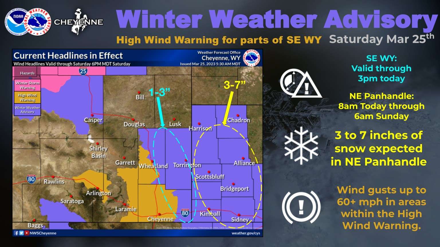
A High Wind Warning remains in effect through 3PM this afternoon, for the wind prone areas of southeast Wyoming, including Arlington/Elk Mountain, Bordeaux, the South Laramie Range and Foothills. The newest update now includes Central Laramie County. Wind gusts up to 65 MPH are possible in areas of the High Wind Warning. Use caution if traveling with lightweight or high profile vehicles.
Snow showers will accumulate across portions of the I-25 corridor into the Nebraska Panhandle today and overnight, which has resulted in a Winter Weather Advisory issuance. The areas in SE WY along and east of the I-25 corridor will have an earlier expiration time of 3pm this afternoon where 1-3 inches of snow is forecast to occur. The highest snowfall accumulations are expected in the Nebraska Panhandle where 3-7 inches are anticipated through early Sunday morning. Localized areas over small distances of moderate to heavy snow in persistent snow bands may result in areas of greater than 7 inches.
There are low to moderate probabilities of an additional at least 4 inches of snowfall this evening through Monday afternoon for portions of southeast Wyoming and western Nebraska. This evening and Sunday night are the main two time periods for the most snowfall. For travel details, refer to wyoroad.info (WY) and/or dot.nebraska.gov (NE)