By National Weather Service in Cheyenne, WY
Winter Storm Watches have been issued for the Snowy Range and South Laramie Range beginning Wednesday morning.
Periods of rain and snowfall are expected across southeast WY and western NE Tuesday morning through Friday with the most impacts being Wednesday and Thursday.
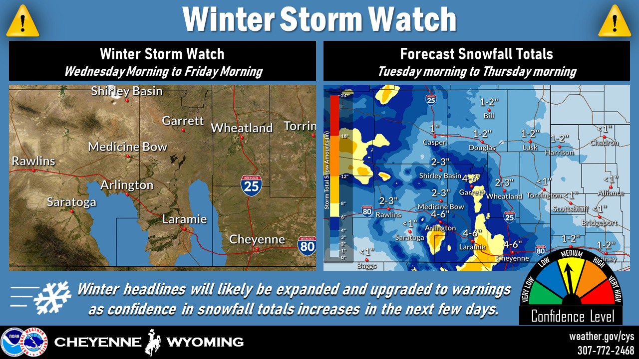
The area with the most travel impacts expected is I-80 between Cheyenne and Elk Mountain in terms of snowfall totals and blowing snow.
Our confidence in these snowfall totals is still medium as there are a lot of unknowns, but as the system moves into our region today and tomorrow, we should have higher confidence and will adjust our headlines and snowfall totals accordingly.