By National Weather Service in Cheyenne, WY
Winter Storm Warnings and Winter Weather Advisories have been issued for portions of our area. Another arctic cold front is on its way this morning and will be responsible for accumulating snow and cold temperatures expected over the next few days.
A few snow showers will push into the northern part of our area this morning, with some light daytime accumulation up to an inch or two around the Pine Ridge in the northern Nebraska panhandle and Converse/Niobrara counties in WY.
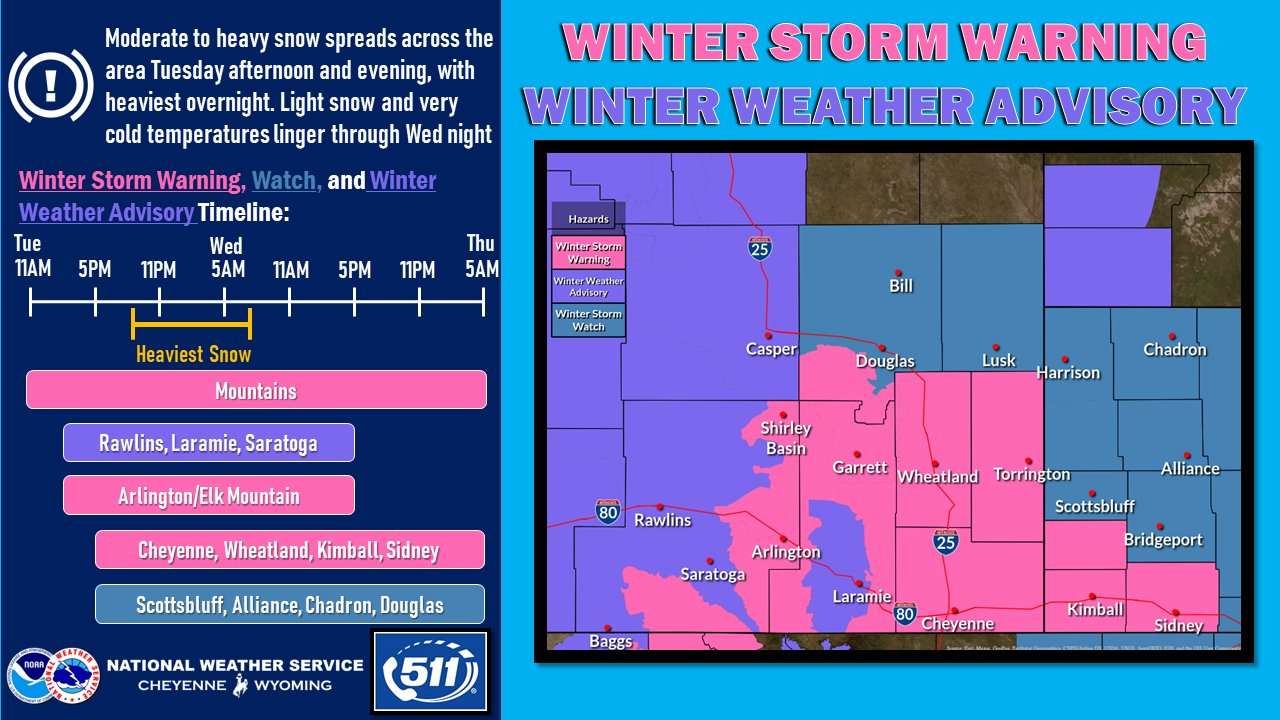
Moderate to heavy snowfall will fill in across the area late this afternoon into the evening, with the heaviest snowfall expected overnight. Total accumulations of 2 to 6 inches expected in the Advisory areas. The Warning areas have the highest probabilities for accumulations of 5 or more inches. Greater uncertainty exists in the Watch areas, but about 4 to 8 inches is possible there.