By National Weather Service in Cheyenne, Wyoming
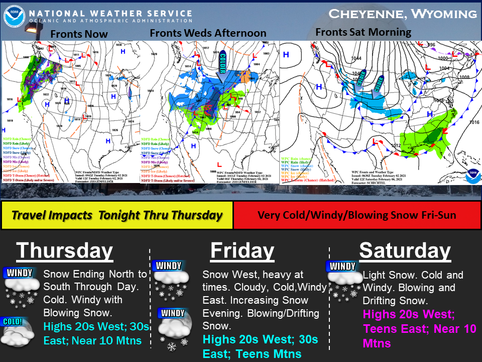
Trying to give you an idea of the progression of this developing winter weather event that is about to happen across southeast Wyoming and Nebraska Panhandle.
A cold front is moving into the Pacific northwest currently. This front is expected to increase winds this evening across southeast Wyoming with increasing chances for heavy mountain snow.
An arctic front, currently across southern Canada, begins to sag south as the first front moves into Wyoming and eventually into Colorado Wednesday.
Really cold temperatures behind this arctic front currently being observed in southern Canada.
Eventually, this arctic front moves into central Wyoming, Friday into Saturday with another round of widespread light snow and strong winds.
Travel impacts looking likely in snow and strong winds over the next several days, especially when that arctic boundary gets down here Friday into Saturday.
Be ready for travel delays and very cold temperatures/windchills Friday and Saturday.
Have a winter weather survival kit in your vehicle if planning travel across southeast Wyoming and Nebraska Panhandle for the next several days.