By National Weather Service in Cheyenne, WY
Slight Risk for Severe Thunderstorms expanded west to include southeast Wyoming along/east of line from Cheyenne to Chugwater to Chadron.
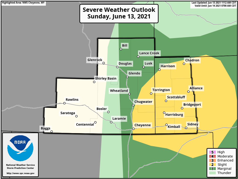
A Marginal Risk area surrounds the Slight Risk area from Cheyenne, to Lusk into extreme southwest South Dakota.
Thunderstorms are expected to develop across parts of southeastern Wyoming and Nebraska Panhandle this afternoon into late evening.
Main threats associated with these storms will be strong downburst winds to 70 mph, lightning, and hail up to golf balls possible.
The main timeframes for these storms runs from 4 PM this afternoon through 11 PM tonight.